When the Land Becomes the Landscape

When the Land Becomes the Landscape

From Xiata Valley to the canyons of the Tianshan, and from the Flaming Mountains to the Taklimakan, gobi and yardang of Xinjiang, northwest China: a journey through the landforms shaped by water, wind and time.

YuanMu Travel · XINJIANG

Across Xinjiang, landforms tell one geomorphic story—from Xiata valleys and Tianshan canyons to Turpan’s Flaming Mountains, Taklamakan dunes, gobi and yardang. Water, wind and time shape what travellers see when green cover falls away.

This Time, Look Beneath the Cover

After lakes, grasslands and forests, the eye can drop lower. Lakes, grasslands and forests have not vanished; they simply step aside for something older, slower and harder: riverbeds, sandstone, gravel, gullies, dunes, and the cuts left by wind and water.

From Zhaosu into Xiata, a valley first behaves like a road. Across the Tianshan, rivers begin to open mountains and sedimentary layers. Continue toward Turpan and the Tarim Basin and green cover thins; bare rock, dunes and gobi take over the view. Along the northwestern edge of the Junggar Basin and farther east, wind reshapes what remains into a different set of forms.

These places can seem unrelated. What joins them is one question: after water, wind, uplift, deposition and immense spans of time have worked on the surface, what shape does the land keep?

When the cover falls away, the landscape does not disappear. The land itself steps forward.
A GEOMORPHIC SEQUENCE · FROM ENTRY TO EXPOSURE
01Water Opens the PassRiver valleys open entry into the mountains
02Water Cuts DeepCanyons carve open sedimentary layers
03Red Beds RevealedMountain strata expose their vibrant colors
04Wind Shapes SandDunes begin to migrate across plains
05Gobi ExposedStone and gravel claim the bare surface
06Yardangs FormedPersistent winds sculpt the standing rock
CHAPTER 01

First, the Mountains Open a Way

A valley is easy to mistake for empty space between two mountains. Walk into one and it becomes something else: a direction the mountains have left open. Water finds the lowest route first. Roads, meadows, woodland and human movement follow.

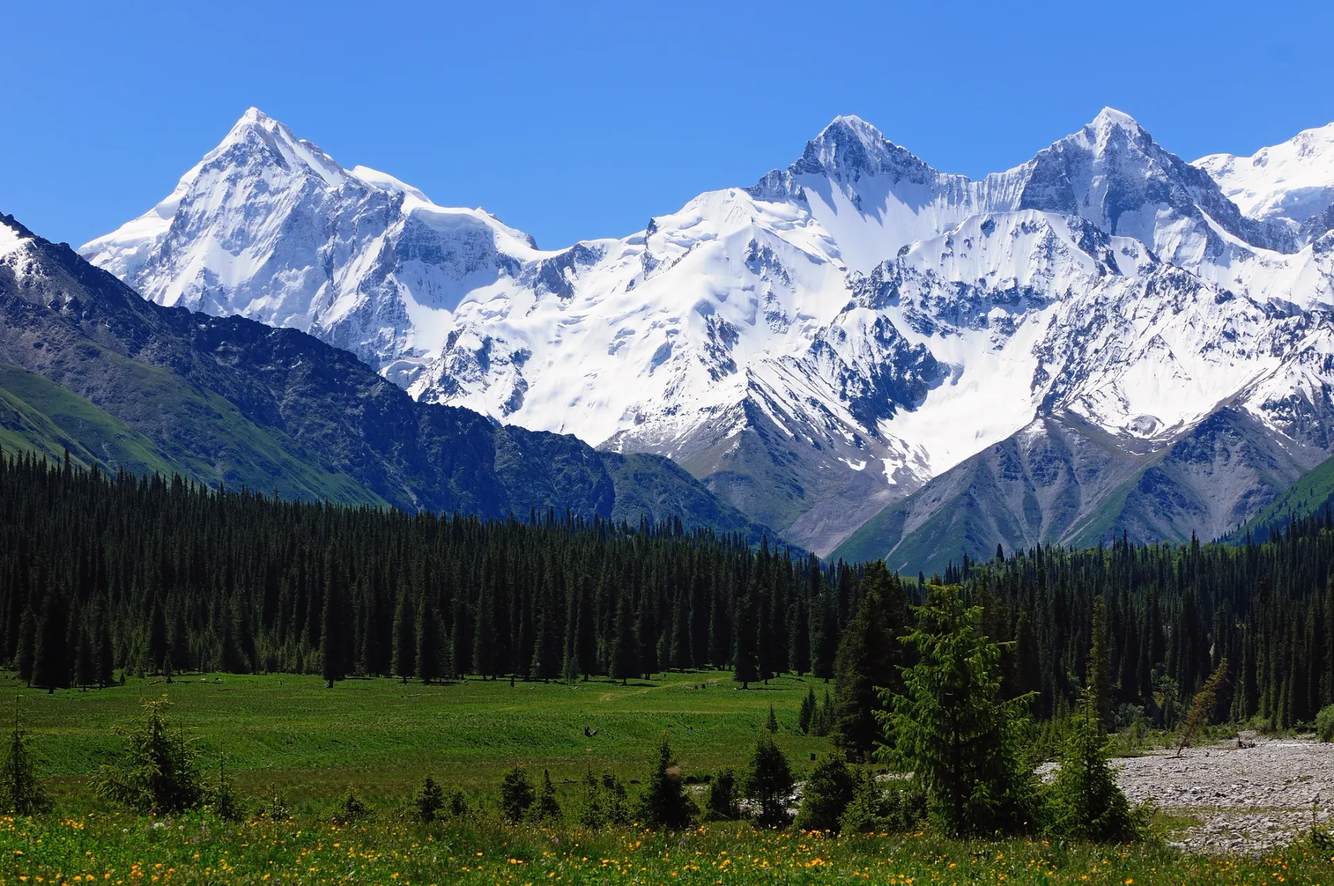
Snow mountains toward the Muzart Glacier from Xiata Valley, Zhaosu, Xinjiang
Zhaosu · Xiata | Meadow, forest and glacier are not three separate attractions. One valley draws them into the same depth of view.
Zhaosu · Xiata

A Valley Is Not an Empty Gap. It Is a Way In.

Xiata first makes you look at the snow peaks. They stand so completely at the head of the valley that the eye is pulled toward them almost at once. Yet the peaks do not determine the journey. The valley beginning under your feet does.

Water occupies the lowest ground. Meadow opens across gentler surfaces. Conifer forest darkens the slopes. Higher still, the landscape returns to rock, snow and ice. Landforms that normally belong to different elevations are compressed into one line of sight. You do not arrive in the high mountains all at once. You enter them layer by layer.

That is one of the simplest differences between a valley and a canyon. A valley gives direction first. It makes the mountains feel enterable.

TRAVEL ADVISORY · Mountain accessibility, road conditions, and hiking routes may change according to season, weather, and local management regulations. Travellers should confirm updated status with official local authorities prior to departure.。
RIVER VALLEYS
In wooded valleys, rivers show where trees remain; in more open gorges, the same waters reveal how people can enter the mountains.

The valleys of Gongnaisi and Tangbula can be read from this angle—not by asking how dense the trees are, or how open the grassland feels, but by watching how water connects mountain spaces at different elevations.

CHAPTER 02

Then Water Stops Guiding — and Starts Cutting

Once a valley is understood as a passage, water reveals another kind of force. It keeps seeking lower ground, but in doing so it opens layers left by deposition, uplift, weathering and erosion. That is why no two canyons have quite the same face.

NORTHERN TIANSHAN SLOPES · ANJIHAI

From Above, a River Looks Like a Cut in the Earth

At Anjihai, the force of the scene is not a single cliff. It is the relationship of the whole incision. The river becomes a thin line at the bottom; terraces and alluvial material spread along the sides; colour and texture change with height. From above, the human scale almost disappears. What remains is the long contest between flowing water and the surface it crosses.

NORTHERN TIANSHAN FOOT · DUSHANZI

At Dushanzi, the First Thing You See Is Texture

Dushanzi is best read through erosion. Grooves, ridges and slopes repeat across the surface without ever becoming identical. Water has cut loose sediment into a field of lines. It feels less like one crack in the ground than an entire surface slowly combed open.

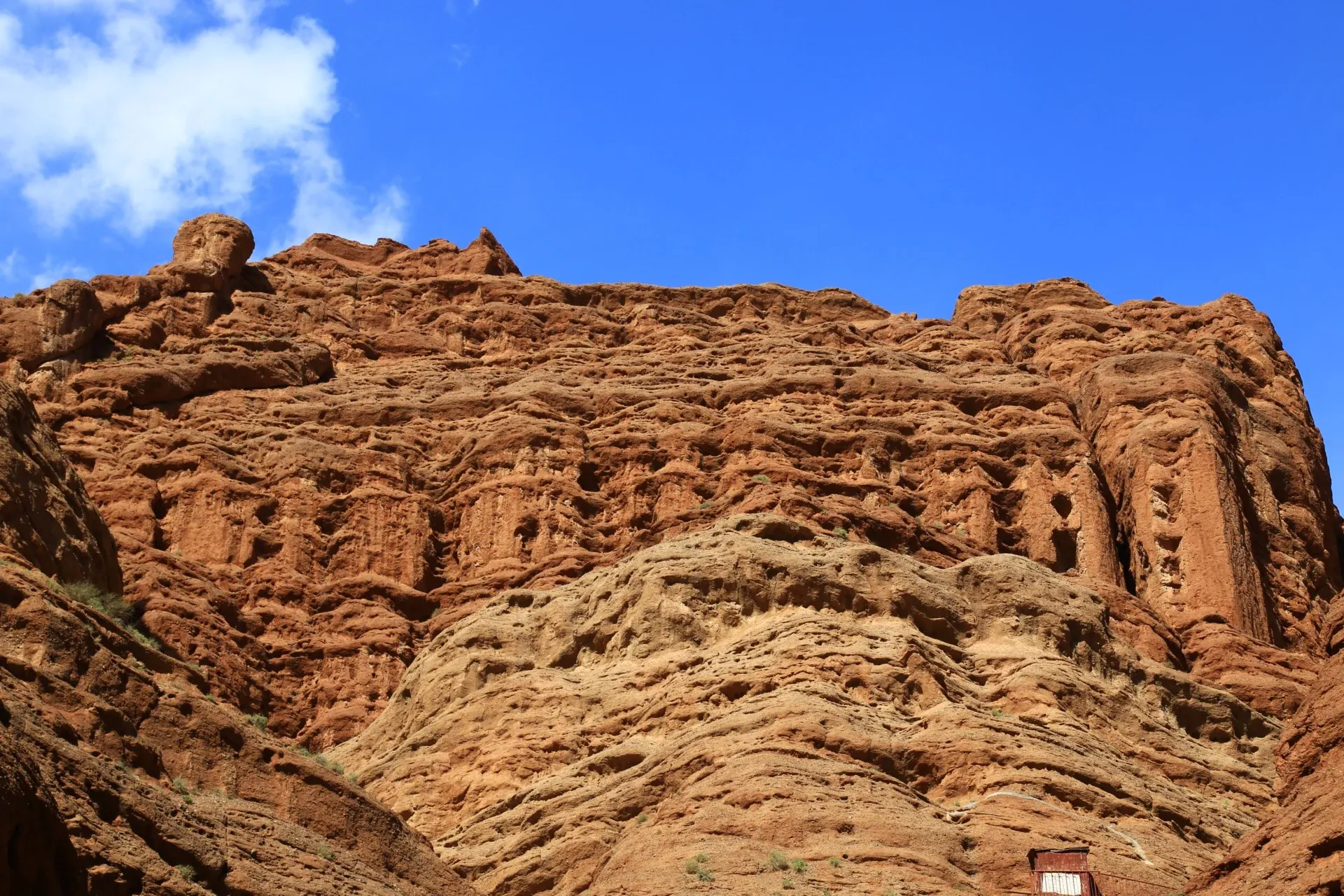
Red-brown rock walls in the Tianshan Mysterious Grand Canyon, Kuqa, Xinjiang
Tianshan Mysterious Grand Canyon, Kuqa | Here the traveller stops looking down into a cut and walks between the red-brown walls.
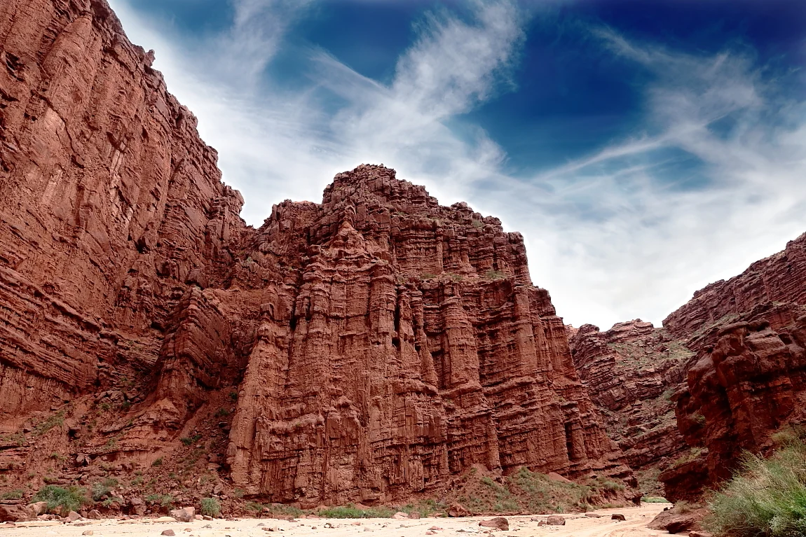
Red rock walls of the Tianshan Tomur Grand Canyon, Xinjiang
Tianshan Tomur Grand Canyon Scenic Area | Multiple erosional and structural landforms gather within the same mountain system.

In Kuqa, You Finally Walk Inside the Cut

The Tianshan Mysterious Grand Canyon in Kuqa changes the way a canyon is seen. Earlier sites are often about looking down across depth. Here you step between red-brown walls and the sky narrows to a strip above. Bedding, bends and weathered surfaces in sandstone and conglomerate are no longer distant geology. They become walls close enough to touch.

For the first time, time itself feels near. You do not need a specialist vocabulary to see that a mountain is not one motionless block of stone. Layers have direction. They fold and fracture. Later, running water opens paths through them again.

One Canyon, More Than One Landform

The Tianshan Tomur Grand Canyon Scenic Area in Kuqa holds interest not only in scale, but in the concentration of different geological forms: red rock, wind-shaped terrain, salt-related landforms and traces of tectonic activity. Together they make the canyon a window onto the evolution of the southern Tianshan.

It is also a useful reminder that “canyon” is only the broad name a traveller gives the view. The processes that made the forms in front of you are far more complicated.

CHAPTER 03

The Mountains Begin to Show Their Own Colour

As the route approaches the arid basins, vegetation covers less of the mountain. Colour no longer comes mainly from grass or leaves. It comes from the rock itself. Red, brown, grey and yellow move directly into the foreground.

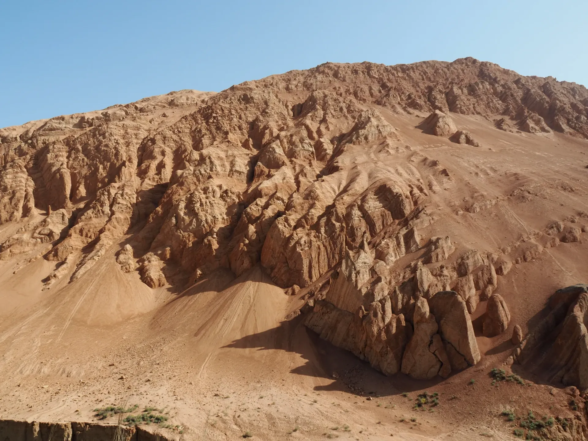
Exposed red mountain slopes and gullies at the Flaming Mountains, Turpan, Xinjiang
Turpan · Flaming Mountains | Light changes the shadows, but the colour belongs to the exposed mountain itself.
Turpan · Flaming Mountains

The Red Is Not Decoration. It Is the Rock.

The Flaming Mountains are easy to let a name overwhelm. Literary associations, summer heat and the language of fire are vivid. Set them aside for a moment, however, and the mountain itself becomes more interesting.

Aridity thins the vegetation, leaving exposed strata directly to sun, temperature swings and erosion. Parallel gullies run down the slopes. The mountain no longer looks wrapped in green; it looks like texture laid open across an entire wall of land. When low morning or evening light arrives, shadow moves through the grooves and the colour gains depth.

The important thing about a red mountain in Xinjiang is not that it resembles fire. It is that almost nothing remains to hide the land from view.

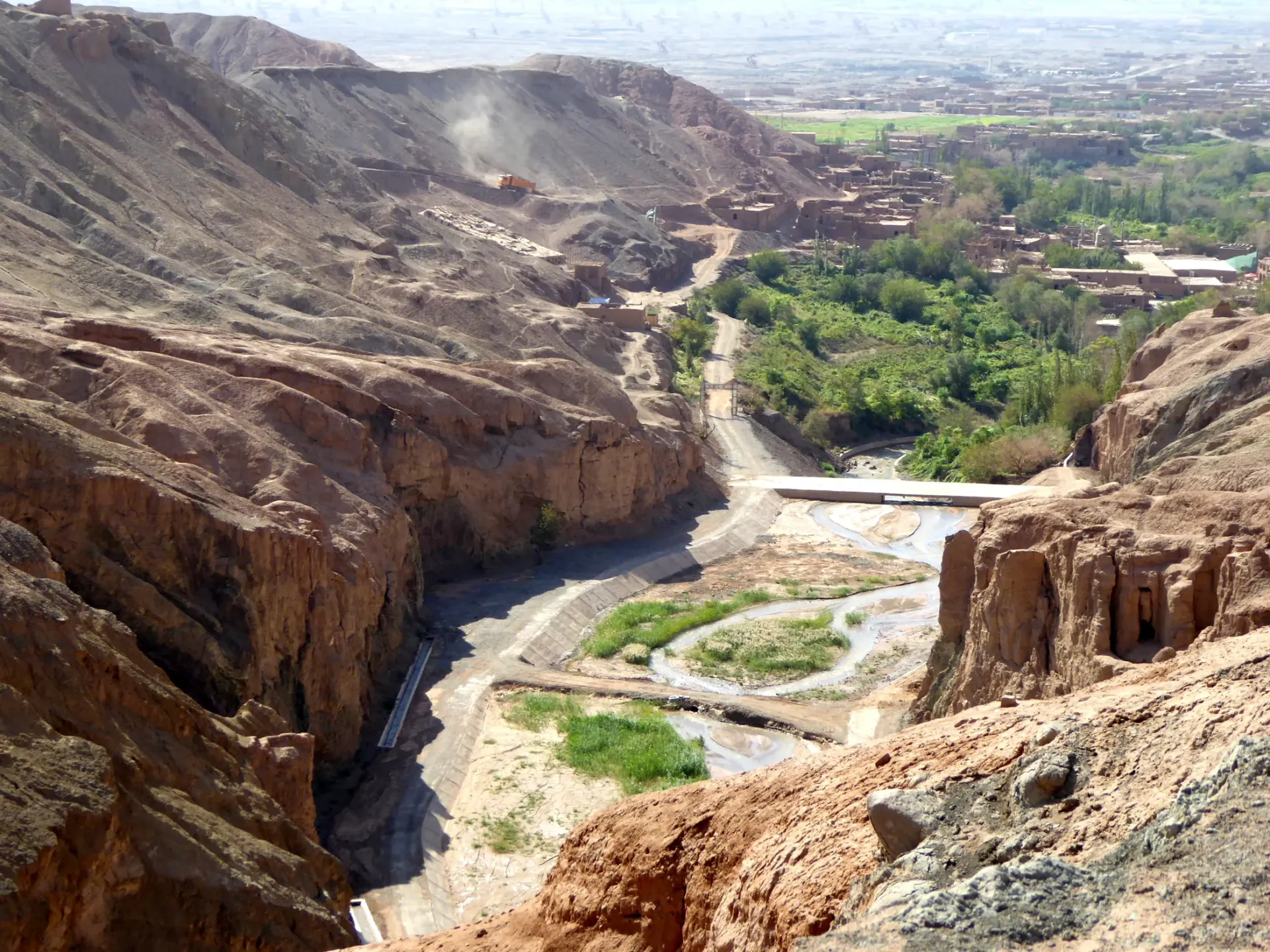
Tuyugou cutting into the Flaming Mountains, with oasis and ravine meeting in Turpan, Xinjiang
Tuyugou | A ravine cuts into the Flaming Mountains, bringing bare rock, road and oasis into the same narrow space.
Turpan · Tuyugou

From the Colour of a Mountain to a Gap Inside It

Seen from afar, the Flaming Mountains form one continuous red wall. At Tuyugou, that continuity breaks. A ravine enters the mountain, a road follows the lower ground, and green suddenly appears where water and people can remain.

This small space matters because it brings “special landforms” back to human scale. Even the driest ground is not completely without life. What matters is where water appears, how long shade lasts, and where a route can pass.

Tuyugou is therefore more than another stop beside the Flaming Mountains. It is as if the distant mountain has been opened, showing how exposed land and daily life can meet inside the same narrow gap.

CHAPTER 04

As Water Recedes, Wind Takes Over

Canyons still preserve the direction of water. In the desert, direction becomes less dependable. The surface can move. Dunes can be reshaped. An edge that looks precise today may not stay where it is.

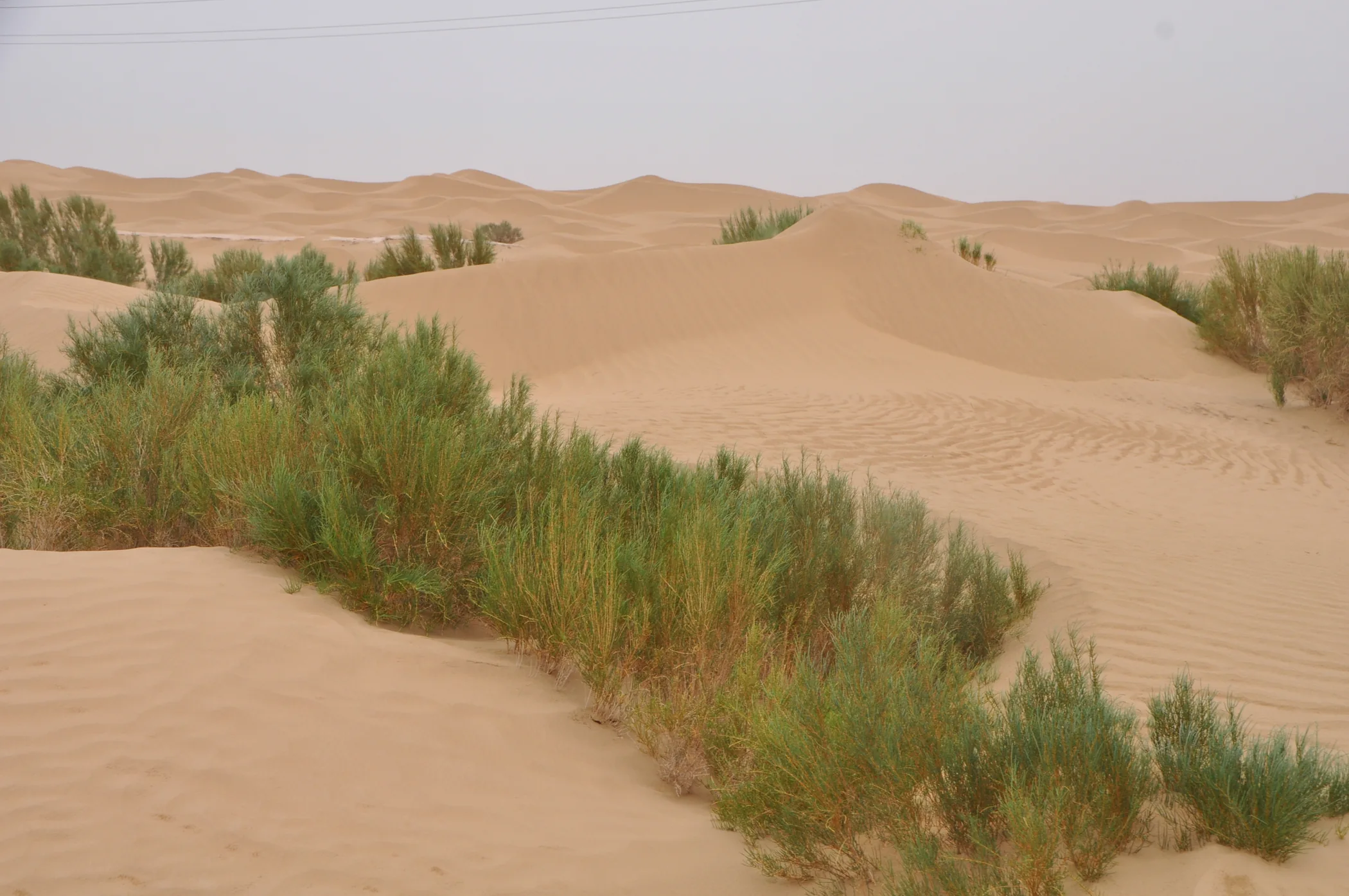
Dunes and drought-tolerant vegetation along the Tarim Desert Highway in Xinjiang
Interior of the Tarim Basin | Dunes are not entirely lifeless; in some areas, drought-tolerant plants draw sparse but visible boundaries across the sand.
Tarim Basin · Taklimakan Desert

A Dune Is Not a Motionless Mountain

From a distance, a dune can look like another kind of mountain. Stay with it longer and the difference becomes clear: rock holds the shape of a mountain; sand gives its shape to the wind.

Wind pushes fine sand up the windward face and carries it away from the crest. The result can look almost minimalist, but it is never truly still. Without trees, buildings or other easy measures of scale, smaller things begin to matter — a ripple, a ridge, one drought-tolerant plant, the slow edge of light moving across a slope.

This is what is often underestimated about the Taklimakan. It is not “nothing”. Because fewer things occupy the frame, every small change in the land becomes easier to see.

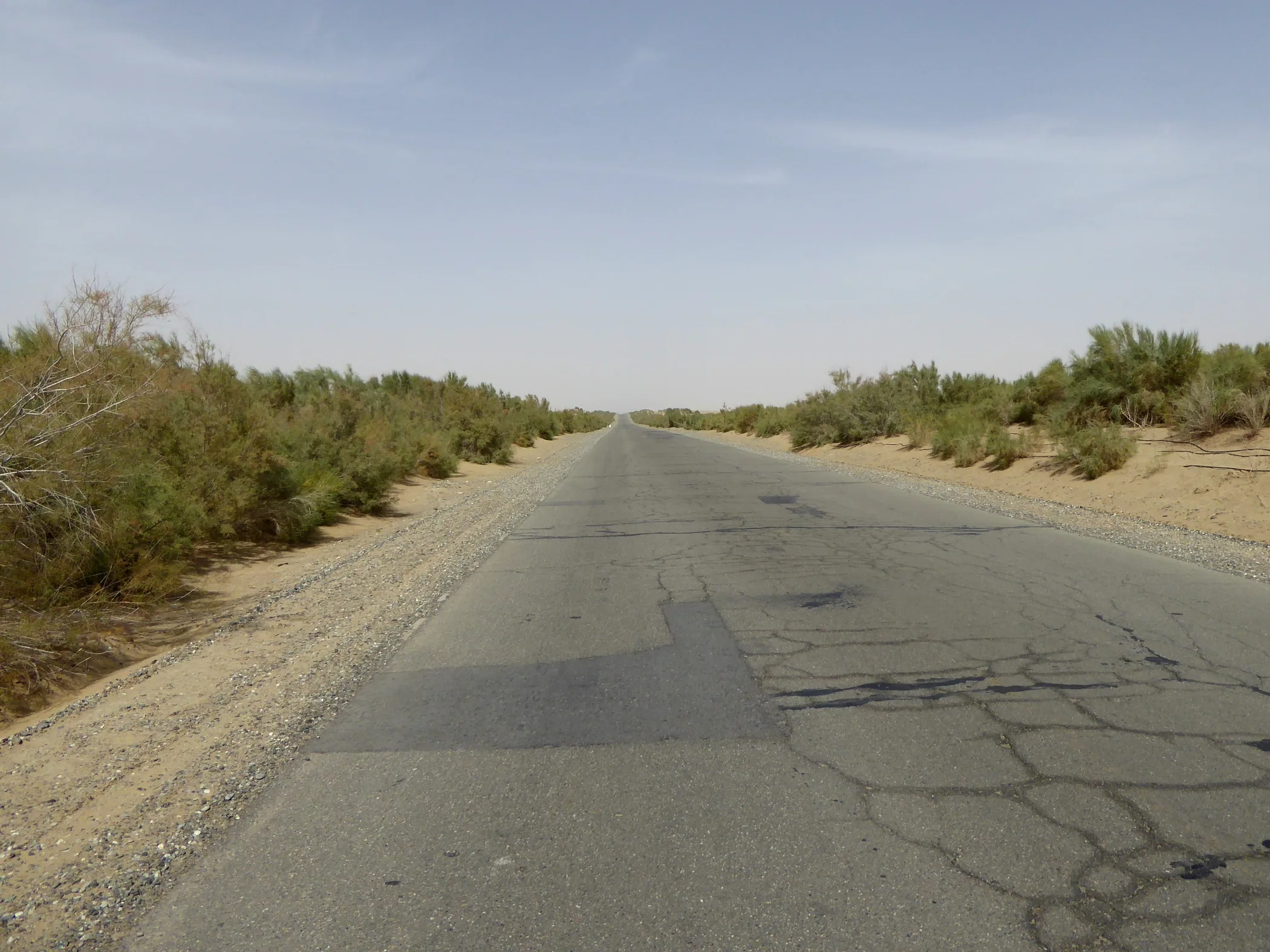
Tarim Desert Highway crossing arid land in the Tarim Basin, Xinjiang
Tarim Desert Highway

One Road Gives Immensity a Scale

When a man-made line enters the desert, vastness suddenly has something to be measured against. The road is not the subject. It simply reveals how much space you are crossing.

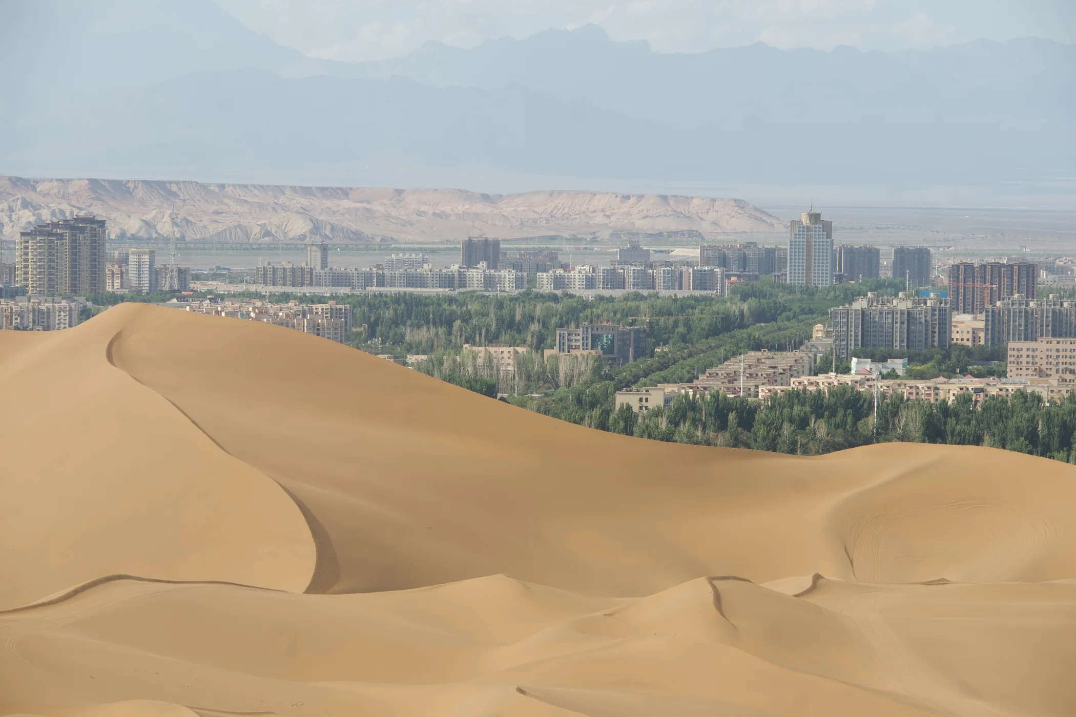
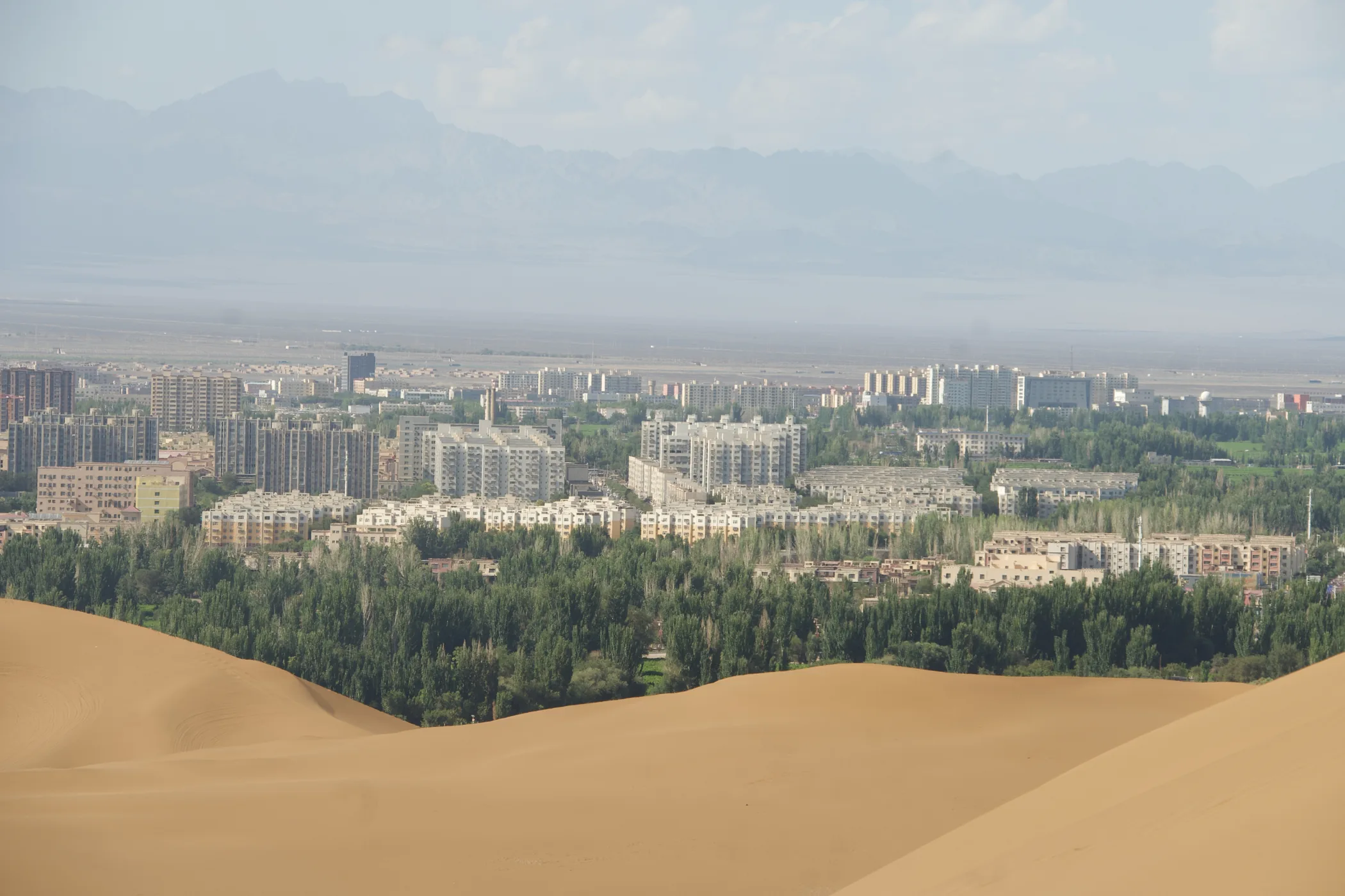
Kumtag dunes beside the urban edge of Shanshan, Xinjiang
Shanshan · Kumtag | Dunes and the edge of the city share the same frame.
View from Kumtag Desert toward Shanshan, Xinjiang
Looking from the dunes toward Shanshan, trees and buildings suddenly give the desert a scale.
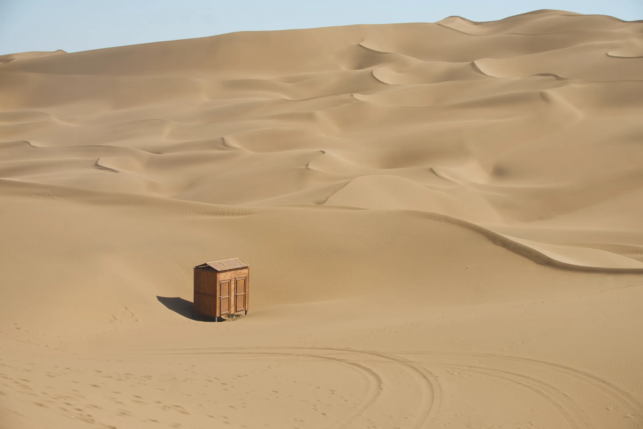
A small hut among shifting dunes in the Kumtag Desert, Xinjiang
Kumtag | A small human structure is enough to make the dunes appear larger.
Shanshan · Kumtag Desert

Where the City Ends, Sand Begins

Kumtag feels very different from the Taklimakan. The latter is an experience of entering a desert of enormous scale. At Shanshan, city and dunes are pressed unusually close together. From higher ground, one side is a sequence of sand ridges; on the other, streets, tree belts and distant mountains are already visible.

That proximity changes the desert from “somewhere far away” into an immediate boundary. The city is not completely separate from arid land, and green cover does not continue forever. Two surfaces confront each other within a short distance. That is one of the most compelling things about Xinjiang’s landforms: not simply what each landscape is, but how quickly one can become another.

CHAPTER 05

In Some Places, Even Sand Gives Way

Arid does not mean desert. Beyond continuous dunes, the surface may become gravel, hard crust, saline ground or exposed rock. The power of the gobi lies in how little it hides.

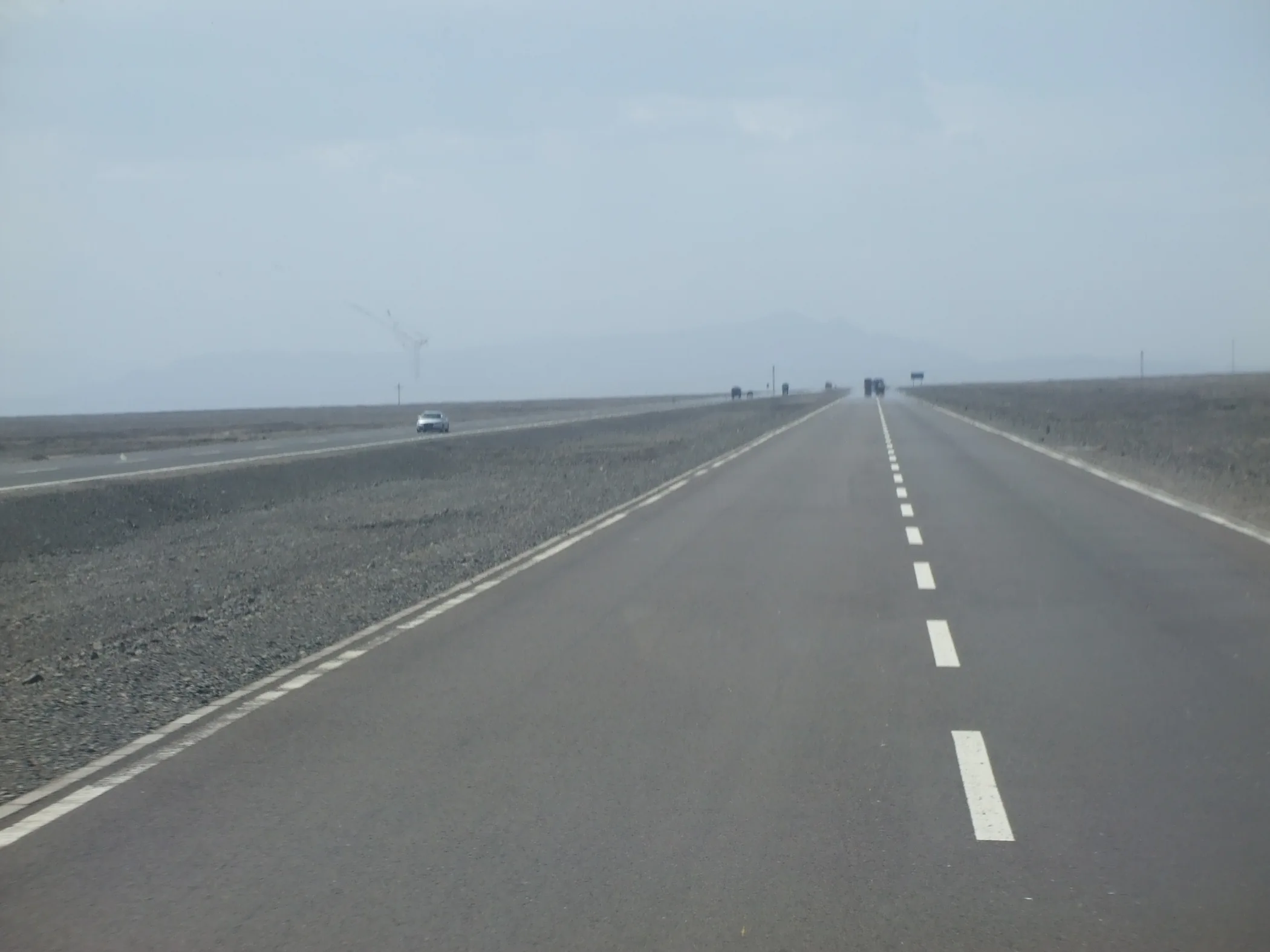
S201 highway crossing gobi country toward Karamay, Xinjiang
A gobi road in northern Xinjiang | Once the dunes recede, the ground becomes flatter and harder, and the horizon seems to move farther away.
Northern Xinjiang · Gobi Country

Gobi Is Not Empty. It Is Exposed.

The first long drive across gobi can create a powerful illusion that “there is nothing here”. There are no tall trees, no continuous dunes, and few objects large enough to hold the eye. Gravel, broken stone and low vegetation continue toward the horizon.

Yet that apparent absence is itself a measure of scale. A highway thins into a line. Vehicles shrink to dots. Distant mountains seem not to move for hours. You begin to understand that desert is often about shape, while gobi is often about distance.

Xinjiang’s arid country is not one uniform field of yellow. Desert and gobi need to be seen separately if the change from mobile sand to exposed gravel is to make sense.

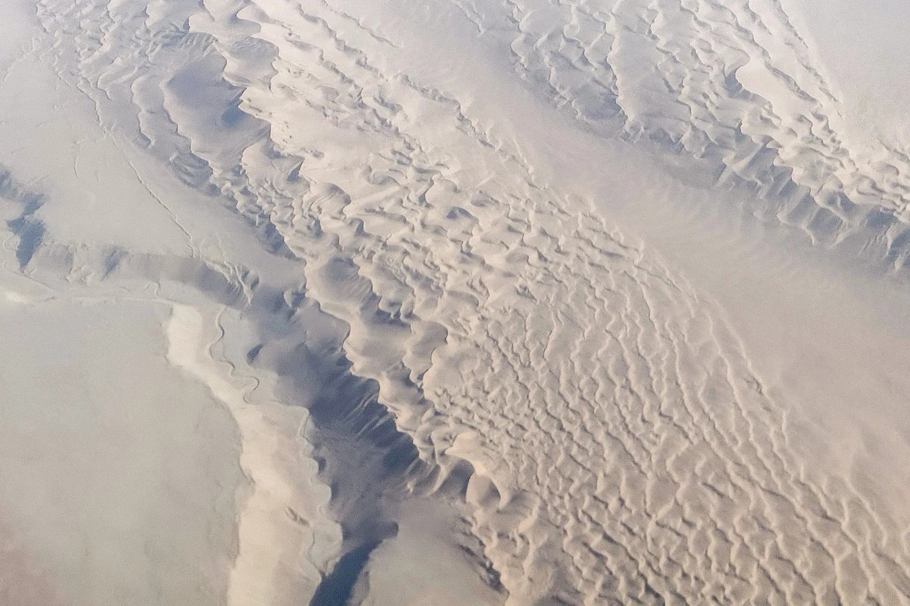
Aerial patterns across arid land near Lop Nur, Xinjiang
Lop Nur region | From the air, the arid surface carries patterns far older and more complicated than any road crossing it.
Lop Nur Region

At the Dry Extreme, the Surface Looks Stripped Bare

The Lop Nur region rewards attention to landforms first. Salt, sand, gravel, wind-eroded surfaces and dry ground overlap until the word “desert” no longer feels precise enough.

From above, lines multiply. Some follow the work of wind; some trace directions once taken by water; others mark salt, surface contraction or boundaries between different sediments. The less vegetation there is to cover the ground, the more directly earlier processes remain written on it.

CHAPTER 06

Wind Carves Rock into Another Kind of City

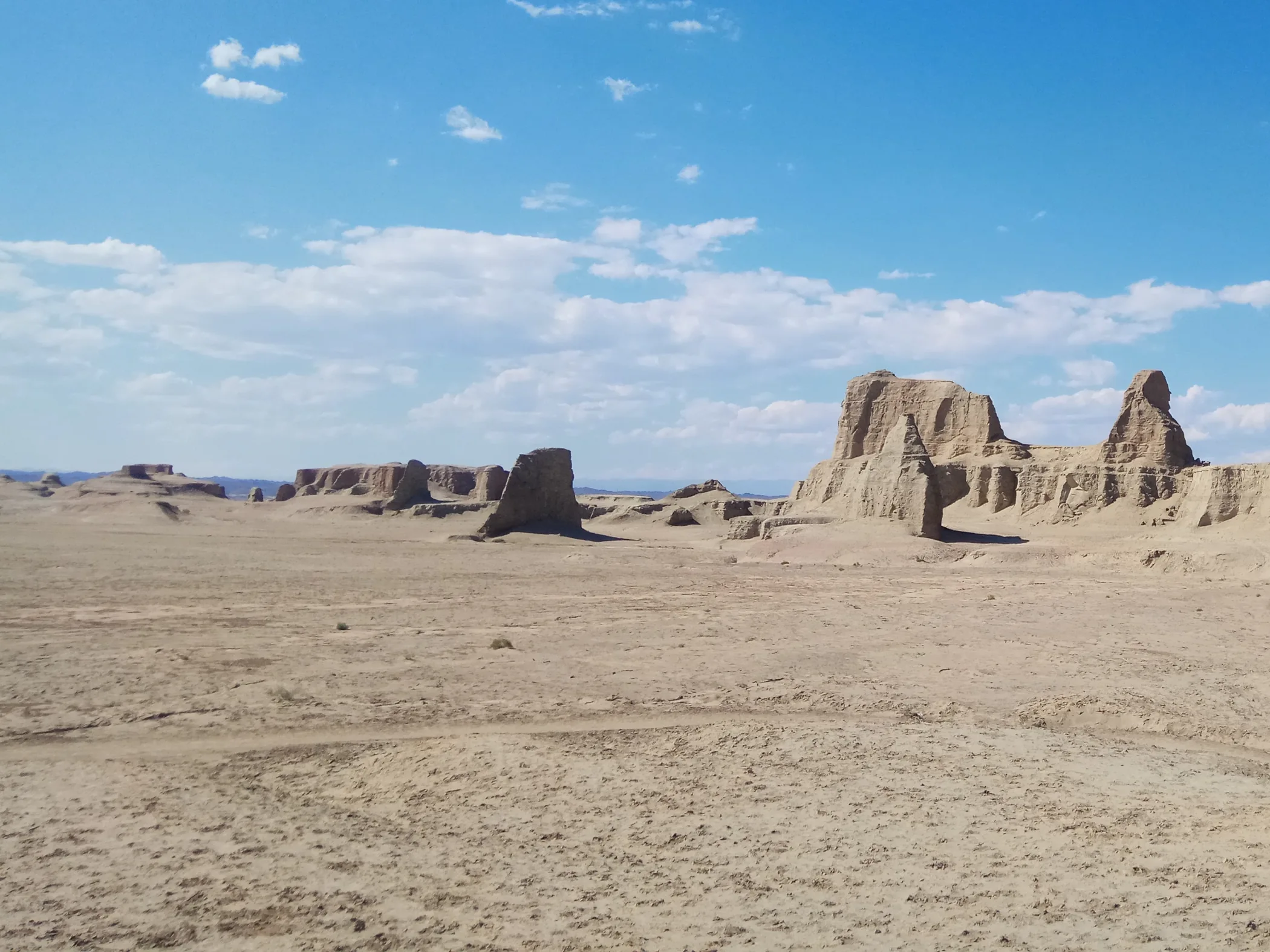
Sand can move; harder rock remains longer. Wind keeps working. Softer material goes first, while more resistant layers persist as mesas, ridges, residual hills and columns. In yardang country, the land begins to invite comparisons with architecture.

Wind-eroded mesas and residual hills in the Urho yardang, Xinjiang
Karamay · Urho Yardang | “World Ghost City” is, before anything else, a yardang landscape shaped by long-term wind erosion and weathering.
Karamay · World Ghost City

Why Yardang Can Look Like Architecture

From a distance, some residual hills resemble towers and some ridges resemble walls. The human eye naturally searches for familiar forms. That is how a “city” begins to appear.

What matters more than finding an object each rock resembles is the order across the whole surface. Sediments of different hardness respond differently to weathering and erosion, leaving forms of different height and shape. Late in the day, longer shadows strengthen the illusion of streets, walls and buildings.

Yardang is best seen with fewer labels. Look instead at direction, spacing, texture and the order left by wind.

HAMI · DAHAIDAO
True wildness does not begin where the road ends; it begins where the sense of human scale vanishes.

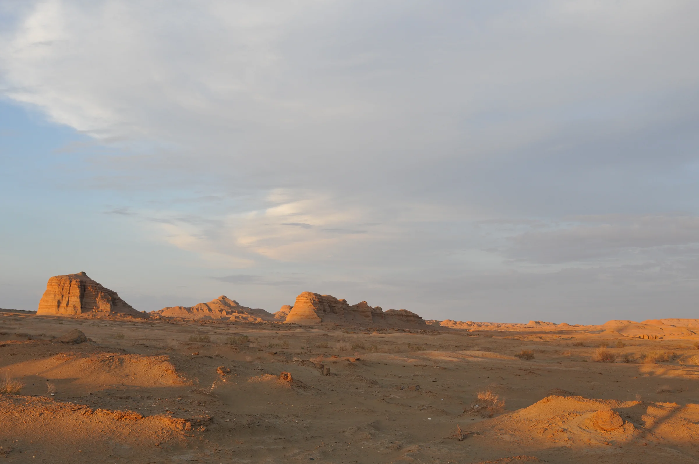
Dahaidao near Hami places gobi, yardang groups and an old route within the same immense space. The Xinjiang natural-resources authorities list the Hami Dahaidao yardang among important geological heritage sites. For travellers, its force is not simply that it feels “more remote”. It is that the visual references of the modern world become scarce, and the landform takes over the entire field of view.

In the End, Only the Land Remains

Lakes let water settle. Grasslands open the mountains. Forests darken the shaded slopes. By the end of this world, the colours that cover the land have gradually fallen behind.

What remains is sandstone, gravel, dunes, salt crust, gullies and ridges shaped by wind. They lack the softness of forest and the completeness of a lake surface, but they preserve time more directly. Where water once ran, which way the wind blows, which layer is harder, which surface was lifted again — many of the answers are still written into shape.

What makes Xinjiang memorable may not be the rarity of any single landform. It is how close radically different surfaces can be to one another. One day you may be following a valley toward glaciers; a few days later you are standing between red rock walls; farther on, the horizon becomes sand and stone. Landscape is not one fixed postcard. It is a sequence of surfaces changing in front of you.

There is no need to choose the “most spectacular” canyon here, or to rank deserts, gobi and yardang. The point is simpler: as the green becomes sparse, the land does not become blank.

Here, the landscape no longer covers the land. The land itself is the landscape.