
High Plateau
The Pamirs
From ancient mountain passes to modern highways, tunnels and a high-plateau airport, explore how the Pamirs connect people, eras and distant worlds.
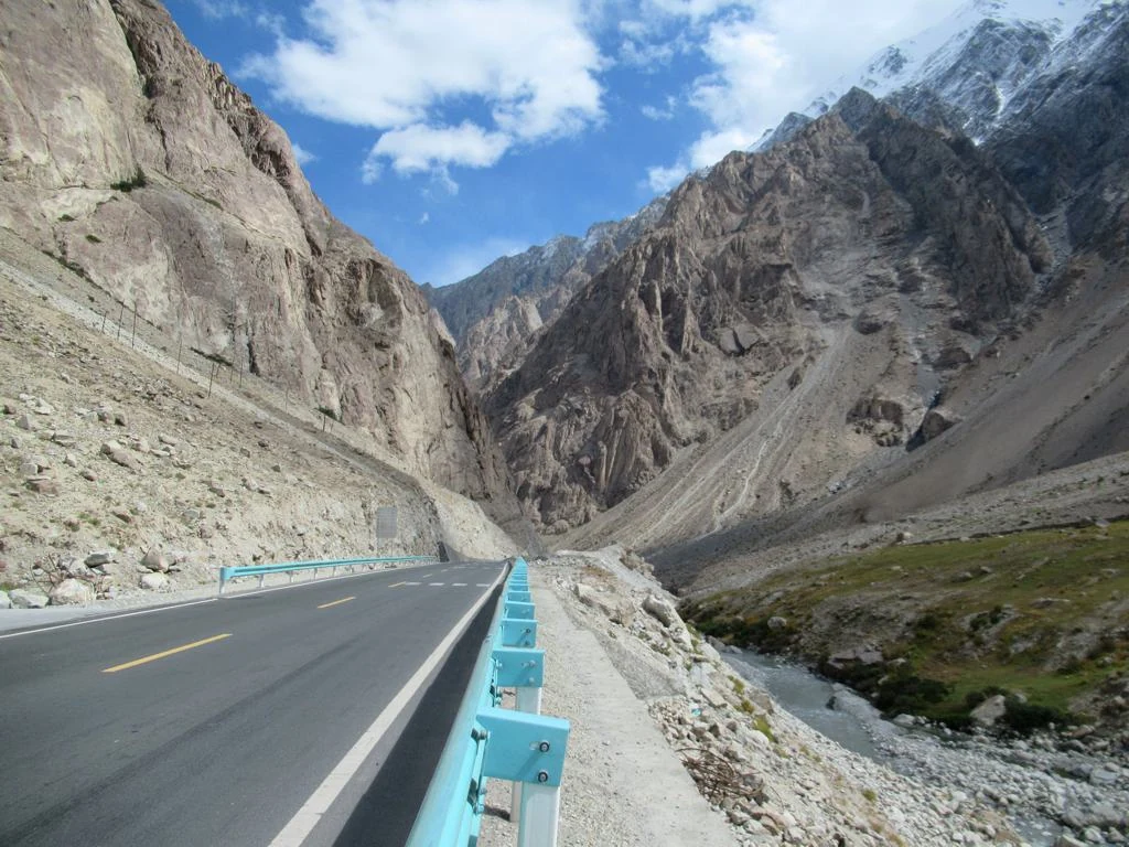
South of Kashgar, the Pamirs are a high plateau of passes, wind and snow peaks where G314 climbs through gorges to Karakul Lake, Tashkurgan and the Tajik border country. Altitude and road conditions define every journey—not height alone, but how mountains are crossed.
South of Kashgar, the road gradually changes what the word distance means.
At first there is still a city around you: traffic lights, shops, petrol stations.
Then the plain begins to fall away. Buildings thin out. The mountains move closer.
The road enters a gorge.
Rock rises on both sides while water follows the carriageway. Beyond another bend, the space suddenly opens and Baisha Lake appears among pale mountains. Farther on, the ice of Muztagh Ata begins to occupy the sky.
Here, distance stops being an abstract number on a map.
It is no longer simply a matter of kilometres.
It becomes a more basic question: when a mountain stands in front of you, where can you get through?
The Pamirs are easily remembered for height.
Snow peaks. Glaciers. Wind. High plateau.
Yet height may not be the force that has most clearly shaped human life here.
Roads have.
For thousands of years, anyone entering the Pamirs has faced essentially the same question:
How do you cross the mountains?
Travel Intelligence · 2026
Last reviewed · August 2026The Mountains Came Before the Roads
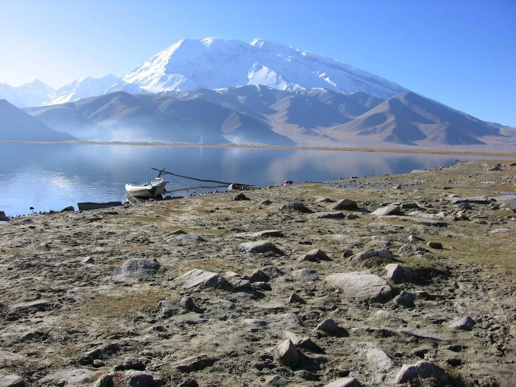
The Pamirs are not one mountain.
They are an entire highland world.
Here the eastern Pamirs meet the great mountain systems of the Kunlun and Karakoram. Immense ridges divide one valley from another and lift the horizon until the sky seems unusually far away.
Standing here, it is easy to feel that mountains divide the world.
Beyond one ridge is another valley.
Beyond another pass may be another language, another way of organising life, even another country.
Modern maps make these divisions appear precise.
Before maps, people worked with a different geography.
Where is the water?
Where is there pasture?
Which pass is open?
When will the snow begin to melt?
Which valley will allow horses, livestock and goods to continue?
Mountains created distance.
They also decided where roads could exist.
People could not simply cross the Pamirs wherever they wished.
They had to find the places the mountains allowed.
That gave passes meaning.
It gave valleys meaning.
It gave meaning to any place where a traveller could stop, find water and exchange news.
The earliest road was not a line drawn by people across the land.
It was first an answer supplied by geography.
The Silk Roads Began as Places You Could Get Through
Today the Silk Roads are usually presented on complete maps.
One city is connected to another. China connects to Central Asia, and Central Asia to places farther west and south.
The people actually travelling those roads did not possess that overview.
They had today.
Could the pass be crossed today?
Had the river risen?
Could the animals continue?
Where was the next place to stop?
In the Pamirs, an old road was never merely a romantic backdrop.
It was a chain of practical judgements.
Merchants passed through.
Monks passed through.
Envoys passed through.
Armies passed through.
Pastoral families did too.
Most of them had no reason to imagine that they were participating in something later described as the exchange of civilisations.
They were trying to reach somewhere else.
But once people move, other things move with them.
Languages.
Stories.
Beliefs.
Food.
Clothing.
Music.
Ideas about places beyond the next range.
Sometimes the most important thing a road does is not connect two cities.
It allows people who did not know one another to meet.
Taxkorgan: Roads Need Somewhere to Pause
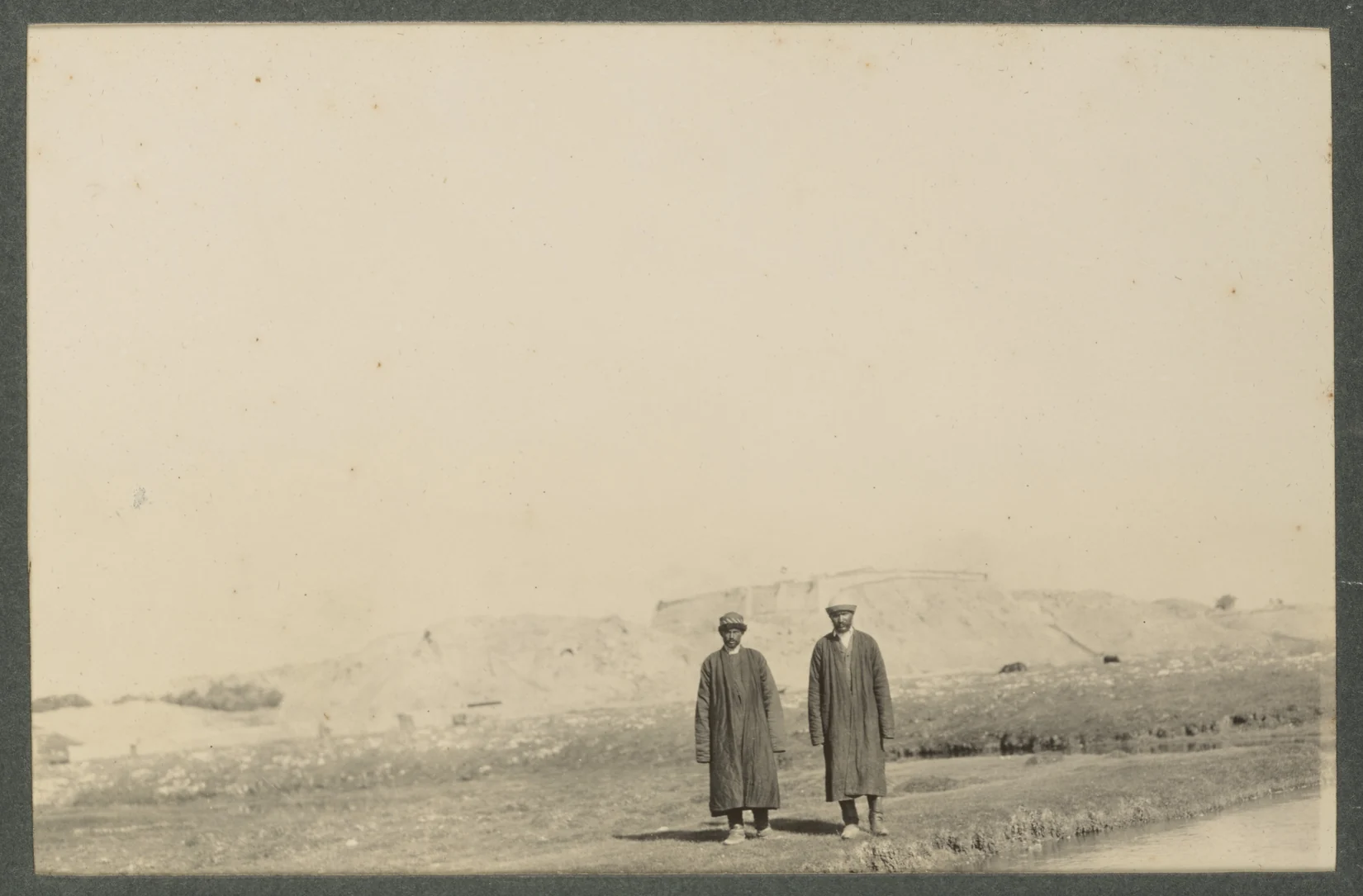
In Taxkorgan — also widely written Tashkurgan in international travel literature — the mountains still surround the town.
Urban streets do not turn the plateau into a separate world.
Look up and snow peaks remain visible.
Roads leave the town in several directions and disappear back into the valleys.
The town simply gathers those routes for a while.
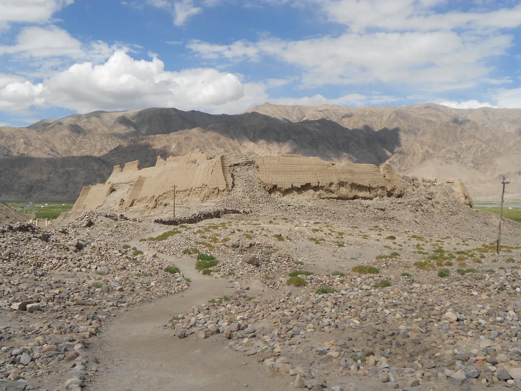
The Ruins of Stone City, beside the modern county town, make this relationship especially clear.
What remains today is a fortified site on high ground.
Below are grassland, river channels and roads.
Beyond them are mountains.
The most useful question is not simply how old the site is.
It is why a settlement was needed here at all.
Roads require nodes.
Someone needs to stop.
Someone needs to exchange goods.
Someone needs food and water.
Someone needs news of the pass ahead.
On a broad plain, a city may expand in many directions.
In the Pamirs, settlement first has to find a place that geography will permit.
Mountain.
River.
Pasture.
Road.
Together, they determine where a town can endure.
Taxkorgan is not a town standing outside the mountains.
It is one of the forms the mountains have allowed human life to take.
Highland Life Is Not the Freedom a Traveller Sees
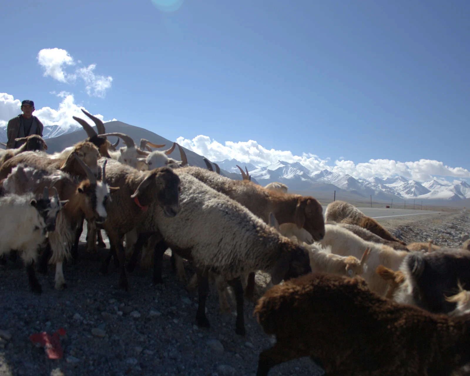
Outside the county town, the road quickly returns to villages, grazing land and mountain valleys.
Sheep and cattle appear.
Yaks stand farther away.
Fodder is stacked beside houses.
This landscape makes the word freedom come easily to a visitor.
The mountains are high.
The sky is enormous.
Animals move slowly across open ground.
The city seems far away.
A household living here has a more complicated list of concerns.
When should livestock move to pasture?
How much fodder will winter require?
Where do the children go to school?
How long does it take an older relative to reach medical care?
When can family members in another valley visit?
Will the road remain passable after snow?
Highland life is not a surviving fragment left behind because the modern world failed to arrive.
Cars are part of family life.
So are phones.
Tourism has entered some villages.
Young people work in the county town or farther away.
Others continue to look after livestock.
Several of these choices may exist within the same family.
The eagle flute is still played, and eagle dances are still performed.
Reducing people to a visual backdrop would miss the more important question.
Why the eagle?
Why should a bird enter dance, music and the way a community imagines itself?
Part of the answer may be the plateau itself.
It is difficult to live here without looking upward.
At the mountains.
At the weather.
At an eagle circling.
At the far end of a road to see whether somebody is coming home.
Culture is not a performance added beside a landscape.
It is one of the explanations people form after living inside a geography for a very long time.
Muztagh Ata: Mountains Enter the Imagination Too
The road continues and Muztagh Ata grows larger.
At first it is an enormous patch of white in the distance.
Then the glaciers acquire texture.
Cloud moves across the lower slopes.
The mountain barely changes position, but the road keeps altering its angle, giving the impression that the traveller is continually drawing nearer.
For a mountaineer, the peak means altitude, route and weather.
For a photographer, it becomes the centre of the frame.
For someone who has lived beneath it for years, it is also something seen almost every day.
Once a mountain is seen often enough, it becomes difficult for it to remain only geology.
It enters names.
Language.
Stories.
A place's understanding of itself.
People rarely live for generations beside something immense without giving it meaning.
We name mountains.
We imagine them as ancestors, guardians or presences.
We tell stories about who crossed them.
We remember those who did not return.
A modern road can shorten the time between a person and a mountain.
It cannot remove the human need to imagine what a mountain means.
Ancient Travellers Searched for Passes. Engineers Read Rock.
The road south from Kashgar is now smooth enough that it is easy to forget one obvious fact:
The road itself is part of the landscape.
It did not occur naturally.
Modern highways follow valleys into the high country, cross rivers and link Kashgar with Taxkorgan and the passes farther south.
But the contrast is not simply that old roads were poor and modern roads are good.
Ancient travellers and modern engineers still confront the same mountains.
Earlier travellers watched snow.
River levels.
Wind.
Passes.
Engineers study gradients.
Rock.
Fault zones.
Freeze-thaw cycles.
Rockfall.
The vocabulary is completely different.
The underlying act is strangely similar:
Reading the mountains.
Earlier travellers looked for places the mountains would allow them to pass.
Engineering now creates more places where passage becomes possible.
A bridge crosses water.
A roadbed enters a gorge.
A tunnel enters rock.
The relationship between people and mountain therefore changes.
It never becomes a simple story of conquest.
Weather, geology and ice can still tell people something very old:
Some journeys must slow down.
When People Began to Arrive from Above
For thousands of years, entering the Pamirs meant finding a road.
A road meant a valley.
A valley meant accepting the entrances the mountains had left open.
Then aircraft arrived.
In 2022, Taxkorgan gained its own high-plateau airport.
It stands more than three thousand metres above sea level.
On descent, the mountains are no longer only in front of a window.
They are below the wing.
The interesting thing is not simply that a remote county gained another form of transport.
A geographical relationship that had lasted for millennia acquired another answer.
Previously, anyone entering the Pamirs had to travel through the mountains.
Now some journeys can arrive above them.
Distance that once meant repeated bends, climbing and descent along a valley can be compressed into a flight.
Yet after the aircraft lands, the mountains remain.
An airport does not remove altitude.
It does not remove weather.
It does not eliminate the real separation between one valley and another.
What technology changes is more subtle:
People gain more choices in how they deal with distance.
That is one of the most important effects of modern infrastructure in the Pamirs.
It does not make geography irrelevant.
It gives geography more than one answer.
The Road Is Still Unfinished
The road history of the Pamirs is still being written.
New routes are entering the mountains.
Between Shache (Yarkant) and Taxkorgan, a new road corridor is being driven through the upper valleys of the Yarkant and Taxkorgan river systems.
Some sections enter uninhabited mountain country.
Tunnels pass into rock.
Construction access roads reach a gorge before the permanent road does.
Engineers face fault zones, deep overburden, freeze-thaw conditions and difficult rock while also having to limit disturbance to a fragile high-altitude environment.
Seen beside the older history of movement, the scene creates a striking comparison.
The earliest travellers looked for valleys.
Later came established tracks.
Then motor roads.
Now tunnels enter the mountains themselves.
The tools become more sophisticated.
The problem has not entirely changed.
There is a mountain ahead.
How do we get through?
Modern engineering and an old caravan belong to very different technological worlds.
Yet both express one extraordinarily persistent human desire:
To know what lies on the other side.
Roads Change the Radius of Everyday Life
Modern infrastructure is easy to describe with numbers.
Kilometres.
Tunnel length.
Airport elevation.
The figures matter.
But people living in the Pamirs do not usually experience a road as an engineering statistic.
A road enters ordinary life.
How long does school take to reach?
How long does a journey to hospital take?
Can farm or livestock products reach a market at the right time?
Can somebody work in the county town and still return home regularly?
How often can relatives meet?
How many days does a parcel take to reach the door?
Routes and border crossings once strongly limited by season can now remain available for longer periods of the year.
In high country, that changes the meaning of winter.
The temperature has not changed.
The number of choices available during winter has.
Modern transport does not reduce the physical distance between mountain peaks.
It changes the radius of everyday life.
The Mountains Did Not Leave When Modernity Arrived
There are two equally simple ways of imagining the Pamirs.
One says the plateau is ancient, remote and isolated.
The other says modern roads have entered the mountains and distance is disappearing.
Neither is sufficient.
The real Pamirs contain several periods at once.
Stone City still stands above the valley.
Weddings still bring relatives together from different places.
The eagle flute is still played.
Livestock still move with the seasons.
At the same time, aircraft land at a high-plateau airport.
Cars travel deep into the valleys.
New tunnels are under construction.
Greenhouses make it possible to grow some produce more reliably at altitude than before.
These things do not cancel one another out.
Tradition does not vanish because an airport exists.
Modernity does not fail to arrive because an old instrument is still played.
The interesting part is how both occupy the same place.
The Pamirs are not a plateau frozen in the past.
Nor are they a landscape remade entirely by modern technology.
They still belong first to the mountains.
Modern life has simply learned new ways to find room among them.
Where Mountain Routes Meet
The road continues south.
The mountains rise higher.
Eventually it reaches the frontier.
On a national map, this is China's far western edge.
Beyond it lies another country.
A border is a precise line on a map.
The mountains do not know the colour of that line.
A river does not change direction because a boundary has been drawn across the human world.
That does not make borders unimportant.
Quite the opposite.
A border makes one fact unusually clear:
A place can feel remote on a map while remaining central to the routes that shape it.
From Beijing, the Pamirs are distant.
Viewed through the mountain systems, valleys and historic routes of Inner Asia, they sit where several worlds come close.
Central Asia lies to one side.
South Asia lies beyond another range.
The Tarim Basin is behind you.
Across another pass, the rivers, languages and patterns of settlement change again.
Distance is never absolute.
It depends on where you begin.
Leaving the Pamirs
The road back to Kashgar is the same road used on the way in.
Muztagh Ata returns to the window.
Baisha Lake reflects the sky from another angle.
The gorge narrows again.
Then the mountains begin to retreat.
Once the road reaches the plain, it is easy to feel that the high country has ended.
It has not.
Roads continue between the ranges.
Another aircraft will land at the airport.
A tunnel under construction will advance a little farther into rock.
Livestock will move again with the season.
Someone will play an eagle flute.
Someone will return from another city for a wedding.
Someone will drive from a village to work in the county town.
Old and modern time continue to occupy the Pamirs together.
People often say that roads connect this region.
Perhaps the opposite is more accurate.
The mountains decide where the roads must go.
Thousands of years ago, people searched for passes.
Later, roads followed valleys.
Today tunnels enter mountains and aircraft arrive above glaciers.
The tools keep changing.
The mountains do not.
They still shape weather.
Rivers.
Roads.
And the effort required to reduce the distance between one person and another.
Modern engineering has not stripped the Pamirs of geography.
It has given people new ways to negotiate with it.
What the Pamirs connect, then, is more than two places.
They connect caravans with highways.
Highland households with distant cities.
Mountain passes with airports.
A vanished age with a road still advancing today.
By the end of the journey, the traveller may no longer be looking only at mountains.
They may be looking at something humans have done here for thousands of years:
Standing on one side of a mountain and trying to reach the other.
Mountains create distance.
People keep creating connections.
Image Credits & RightsView details
Creators, source pages and applicable licences for verified images used on this page are listed below. Images are used for editorial display on this page only, subject to the stated licence or rights-holder permission.
- Karakoram Highway (cover) | David Stanley | CC BY 2.0
- Muztagh Ata and Karakul Lake | Colegota | CC BY-SA 2.5 ES
- Stone City, Taxkorgan | Drgkl | CC BY-SA 3.0
- Livestock beside the Karakoram Highway | prestonrhea | CC BY-SA 2.0
- Taxkorgan and the Sarikol Valley, 1915 | Sir Percy Sykes | Public Domain